 Pikes Peak SOTA: Hike from Devils Playground

I’ve been up Pikes Peak (W0C/FR-004) a zillion times via the Pikes Peak Highway and the Pikes Peak Cog Railway (currently out of service) doing SOTA activations, working VHF contests, participating in the Colorado 14er Event, maintaining repeaters and escorting visitors from out of town. See my previous post on activating by driving up the mountain: How To Do a SOTA Activation on Pikes Peak.
Joyce/K0JJW and I had Pikes on our SOTA activation list for 2018 but wanted to do a hike to access the summit. The classic climbing route up Pikes is via Barr Trail, a 13-mile trail that ascends 7800 vertical feet. This is a difficult climb for most humans but I will note that serious runners routinely run up the mountain just for fun. See Fred/KT5X’s comments on the SOTA database about running up the mountain and then doing a SOTA activation.
Another hiking alternative on the northwest side of Pikes Peak is the Crags Trail, also known as the Northwest Slopes route. This route starts about 4 miles south of Divide, CO at the Crags Campground. This hike is 7 miles one-way with 4300 vertical feet. This is easier than Barr Trail but still a significant climb.

Devils Playground
There is a shorter option that does not get much attention (except from some of the locals). The Northwest Slopes route crosses the Pikes Peak Highway at Mile 16 at a popular spot called Devils Playground. There is a large parking area there and the Northwest Slopes trail can be accessed at this point. Just cross the road, step over a cable fence (intended to block vehicles, not people) and follow the obvious trail to the summit.
Note: currently access to the summit by car is restricted due to summit house construction and Devils Playground is a staging area for free shuttle buses that take visitors to the summit.
This trail is 2.6 miles one way and 1300 feet vertical (mostly uphill but some up and down action). The last quarter mile before the summit is rocky and steep. The trail becomes more difficult to follow at this point but careful attention to the cairns will keep you on the right path. As shown on the map, this trail tends to stay close to the road so you will see vehicles along the way. All in all, this was a nice hike on a good trail.
Once on top, we set up our standard 2m FM station: Yaesu FT-90 and the Arrow 3-element yagi antenna. We quickly had a pileup on 146.52 MHz. It is kind of crazy up there when everyone starts calling because you are hearing everyone but the chasers are not.

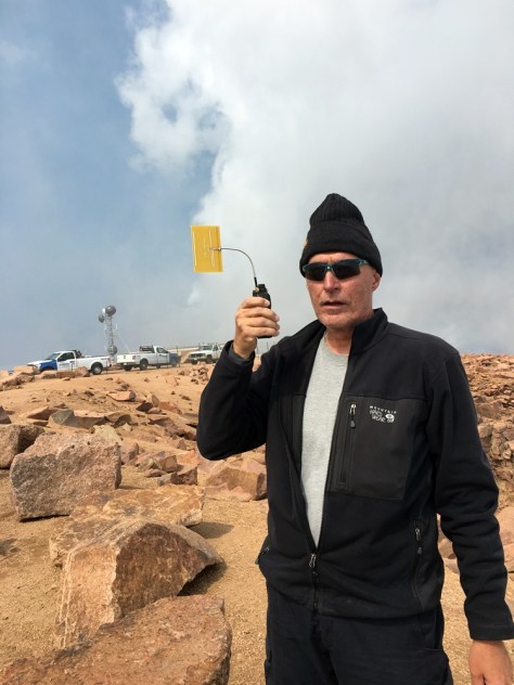
It was great to work Steve/WG0AT on Mt Herman (W0C/FR-063) and Brad/WA6MM on Mount Morrison (W0C/FR-092). I also worked Paul/W0RW on 1.2 GHz with my Alinco HT driving a two-element yagi PC-board antenna. (A quick comparison between the rubber duck and the yagi confirmed that the yagi does have some gain.) We ended up in a bit of a hurry as the clouds moved in but tried to work everyone we could. Our best DX on 2m FM was Dave/N0KM near Del Norte, about 100 miles away. On our way down, the clouds were in and out but no storms or lightning.
All of the usual warnings apply for hiking above treeline: start early and get off the mountain before the storms move in.
73 Bob K0NR
The post Pikes Peak SOTA: Hike from Devils Playground appeared first on The KØNR Radio Site.


